"The cure for boredom is curiosity," Dorothy Parker once wrote. "There is no cure for curiosity."
All of the images that you are about to see in this post have been scanned from a publication that I rescued, out of curiosity, from the discard table at the NDC Red River College Library:
")
")
"Mobile Homes in Metropolitan Winnipeg and the Additional Zone", released by the Metropolitan Corporation of Greater Winnipeg Planning Division in February of 1970. (With old-style thick plastic coil-binding, so you can imagine the fun I had scanning it.)
Oh, sure, maybe at first blush that doesn't sound like a particularly enthralling topic -- but this planning report would've been put together just as the original Unicity documents were being pitched and prepared, so the Winnipeg Planning Department probably felt that it had to be prepared for anything. Mobile homes may not have been the most important looming-unification consideration at the time, perhaps, but they still had to be tackled nonetheless; a planning department does not, generally, prefer to leave things unplanned.
Thus it was that it fell to an unknown author, presumably whichever staffer drew the short straw at work that day, to compile and present everything that he-or-she-but-probably-he could dig up on the mobile-home situation in and around the greater Winnipeg area. And I do mean 'everything':
")
")
")
")
")
")
Whoof! So while you may not be taking the mobile-home situation very seriously, little mister-or-missy, rest assured that the Metropolitan Corporation of Greater Winnipeg Planning Division most certainly does.
Here's what the study set out to establish:
")
And here is everything you need to know about the mobile home representation in each then-municipality, including fees, number of spaces, population broken down by age groups, bus routes and distances to amenities:
")
")
You'll note that Transcona kiboshed a proposed trailer park the year previous, which I'm sure went a long way to preserving its stellar repu...ta... y'ever wonder why Transcona still puts up with Unicity? The rest of the city basically treats it the way Canada treats Newfoundland (or used to, back before Newfoundland wielded oil money), so I sometimes find myself wondering why Transcona has never just said 'screw it' and Headingleyed out of the arrangement entirely.
Anyway. Side note. Moving on.
I should also note that, this being an old library book, somebody long ago went through it with a pen and underlined various passages of it. (Of course they did.) I'm sure you're curious, or perhaps thinking of writing a paper on this very topic yourself -- don't lie to me, you're considerin' it, I see you back there -- so, for posterity, here are all of the underlined or side-lined fragments in the book:
"sales in Manitoba in 1974 could amount to about 2,600 homes." (p. 7)
"Manitoba could be faced with finding locations for as many as 6,000 homes of these types in 1974." (p. 8)
"average family size is lower than in conventional housing" (p. 11)
"1,070 total resident population, only 158 are of school age." [. . .] "15%" (p. 12)
"Whilst on this subject, it should be mentioned that all local improvements in the mobile home parks are paid for by the developer, and the operator in addition to the license fee pays realty and business taxes." (p. 12) [sic]
"first two categories" [. . .] "catered for in mobile home parks which could be privately operated" [or] "a co-operative venture" (p. 30)
"minimum lot size should be 3,600 square feet" (p. 47)
"The Canadian Mobile Home Association Model by-law recommended a lot-size of 2,400 square feet as the basic minimum, and in 1966 the United States Department of Health, Education and Welfare recommended that 'every mobile home lot should contain at least 2,500 square feet of area to accommodate modern mobile homes and other structures.'" (p. 48)
"Our own Metropolitan standards require a minimum lot-area of 2,400 square feet and the Provincial regulations require 1,500 square feet. The Provincial regulations are geared, however, more to the tourist trailer than the mobile home. (p. 48)
"It is recommended therefore that the minimum lot-area requirement for a mobile home subdivision be 3,500 square feet." (p. 49)
"roads, pedestrian sidewalks and recreation areas" [. . .] "about 35% of the land area is used for these purposes." (p. 50)
"shall be five acres [. . .] "minimum number of mobile home spaces shall be fifty" [. . .] "minimum site width for a mobile home park shall be 300 feet." (Appendix A)
"Density. The maximum permissible density for a Mobile Home Park shall be 12 mobile home spaces per gross acre." (Appendix A)
Tantalizing snippets all! I dig the 'whilst' in there, very cheeky on the part of whatever unidentified City staffer typed this up forty-three years ago. ("Ahhhh, them eggheads up in the Planning division, y'know how they get sometimes.")
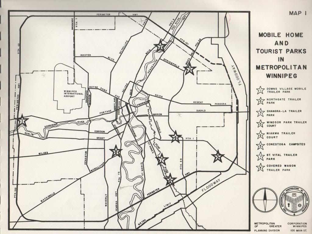
But enough talk! Pictures being worth a thousand words, and all that, let's break out the map:
")
[ 1600x1200 | 3200x2400 ]
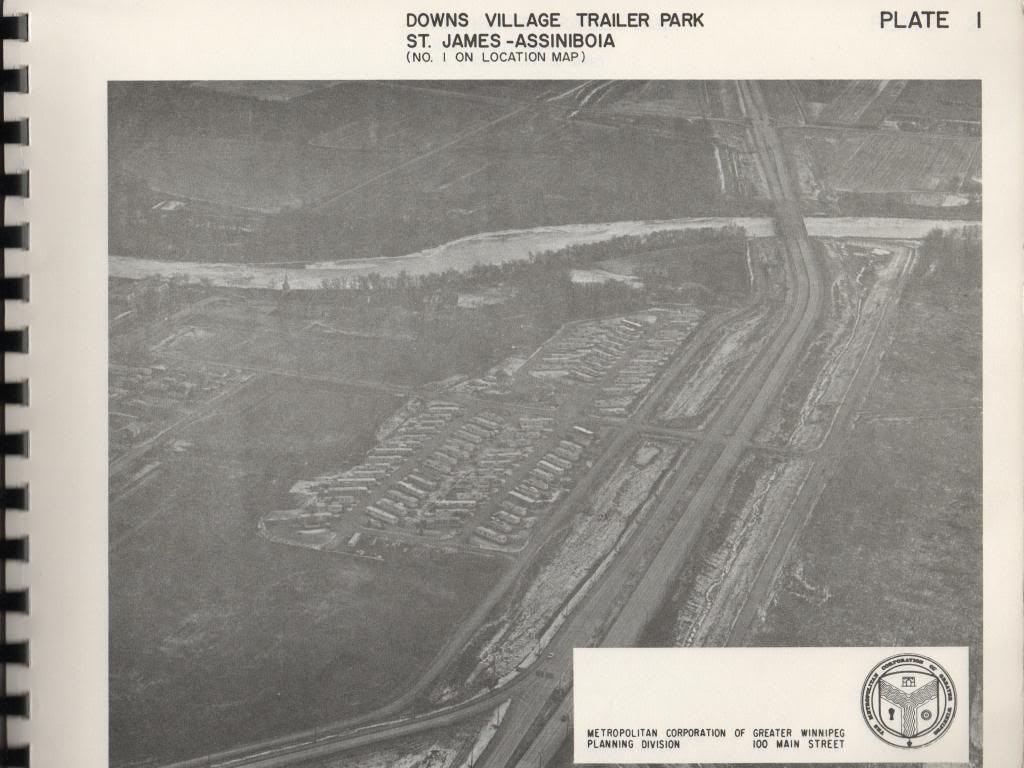
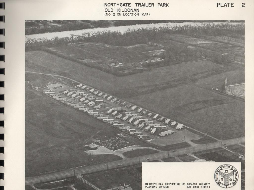
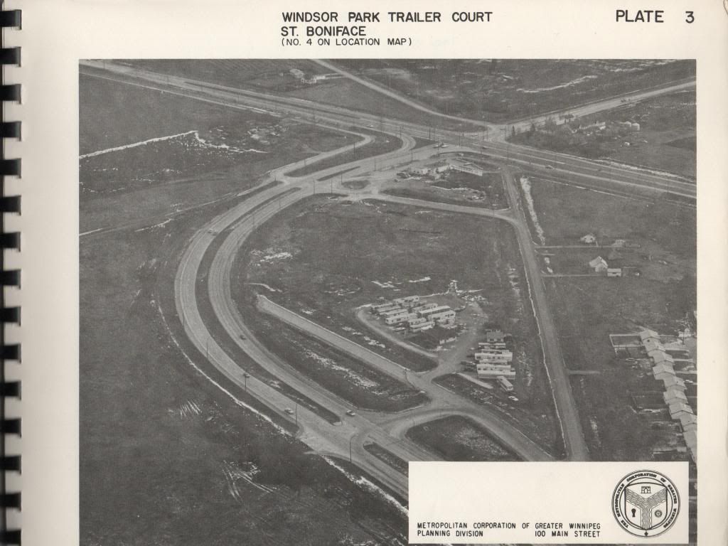
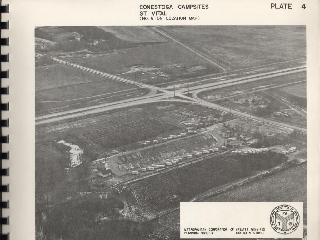
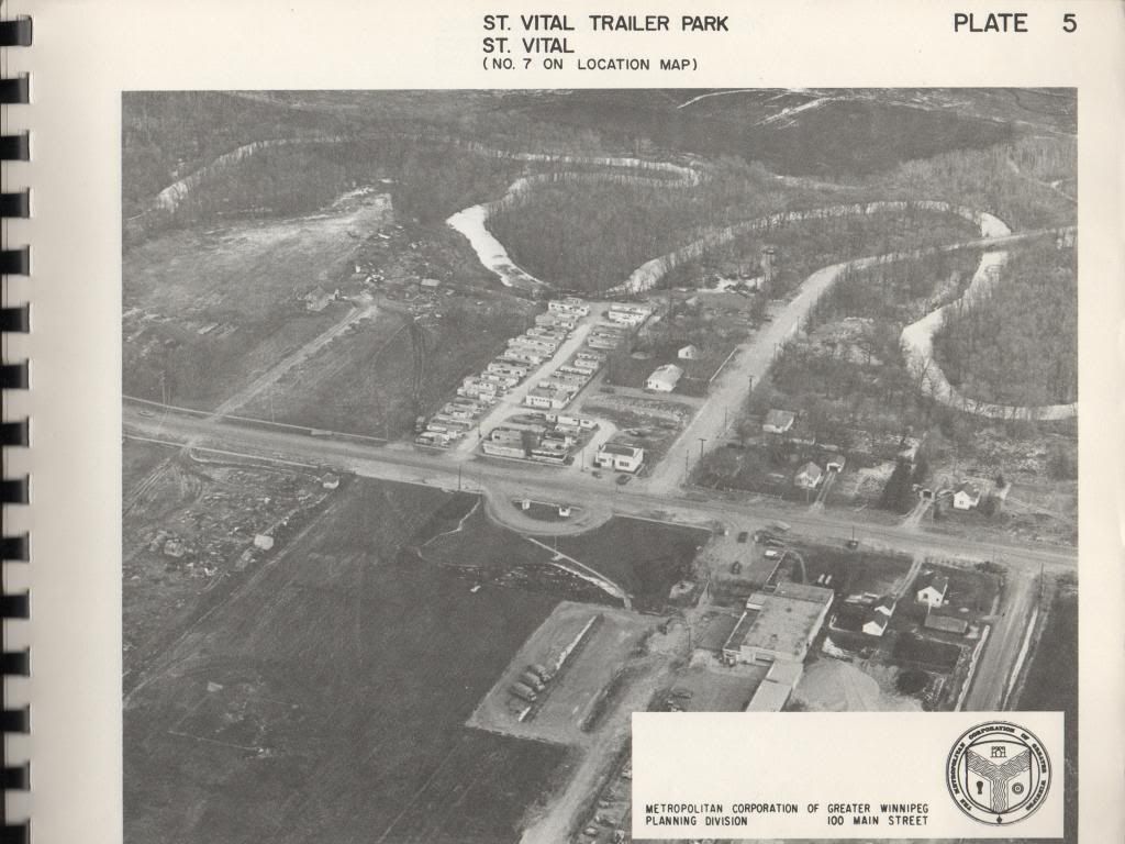
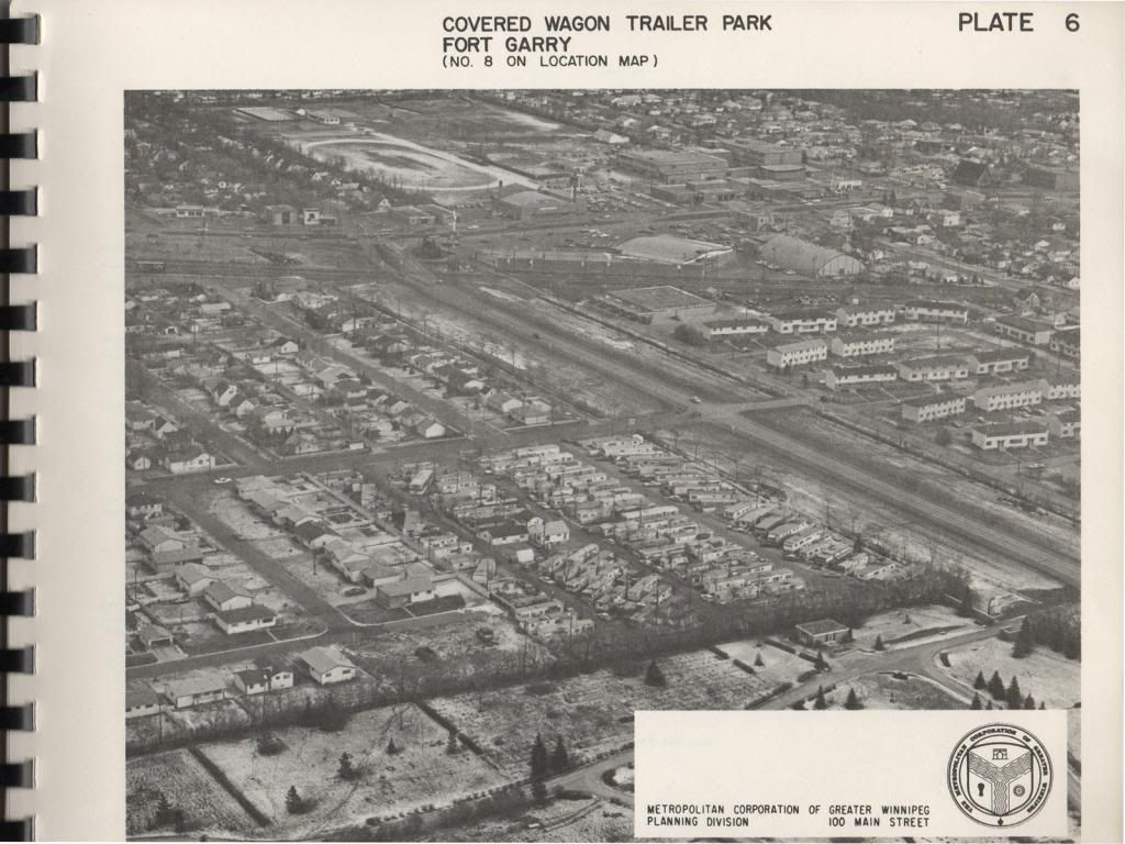
And here are aerial photographs of each of those locations, in beautiful black and white:
")
[ 1600x1200 | 3200x2400 ]
")
[ 1600x1200 | 3200x2400 ]
")
[ 1600x1200 | 3200x2400 ]
")
[ 1600x1200 | 3200x2400 ]
")
[ 1600x1200 | 3200x2400 ]
")
[ 1600x1200 | 3200x2400 ]
Can we just take a moment to admire that banner, there? I dig the crest on it, I'd legit wear that on a t-shirt.
")

With our powers united under that great trinity of planning symbols -- the Fort, the Keyhole, and the Metal Blade from Mega Man 2 -- we shall reign!
If you were also wondering how the different types of trailer parks were generally laid out back in those days, well, don't you worry, we've got that covered too:
")
")
")
")
")
")
")
")
Plate 14 looks like it could've been coloured in and hung as artwork at the old Airport, but what I like best here is the vaguely South American vibe that plates 10 and especially 11 give off. Right? Maps of temple ruins? Anybody? No?
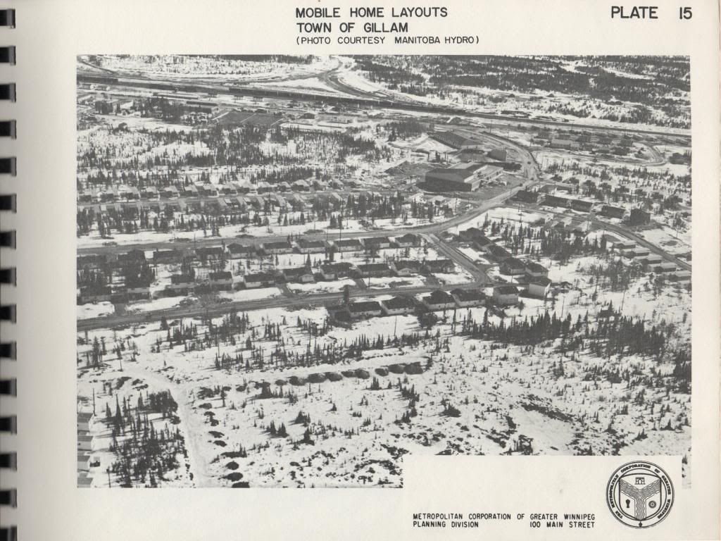
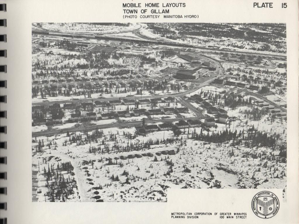
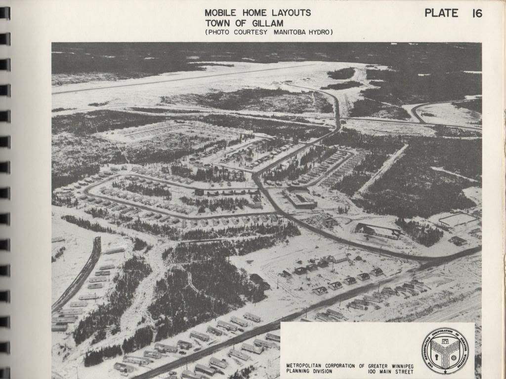
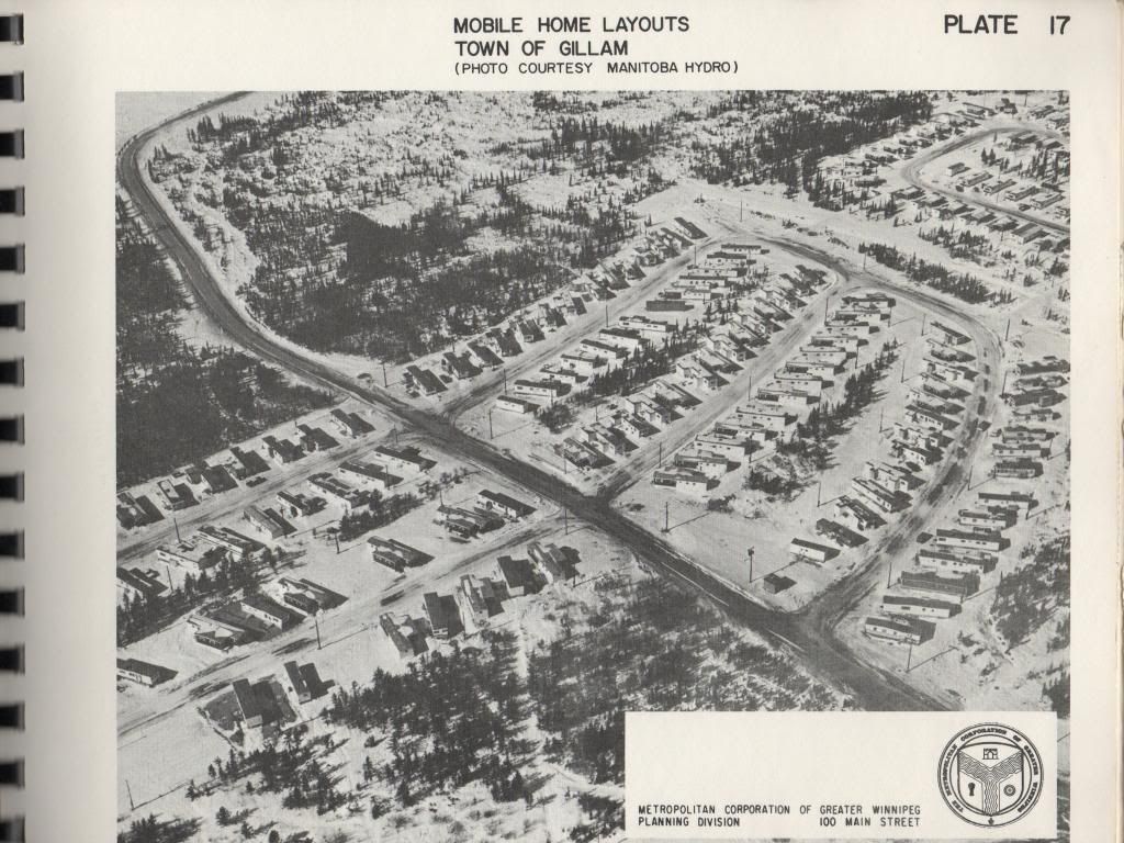
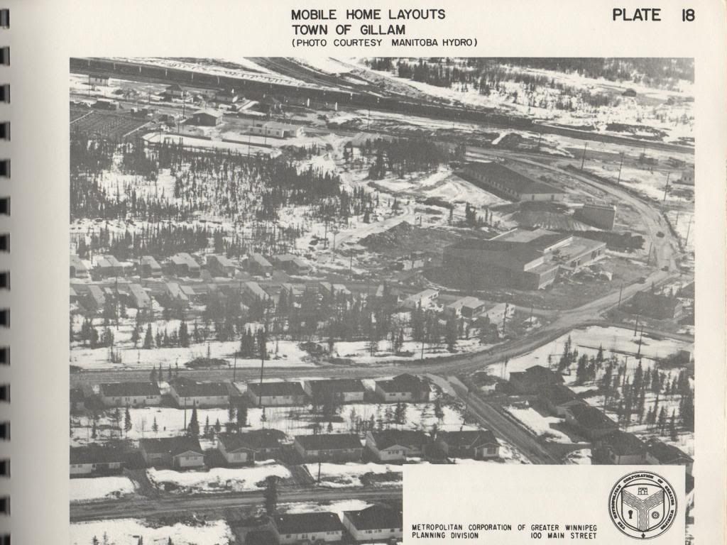
Anyway, the report provides plates seven through fourteen to highlight how poorly laid out the parks in plates one through six were, going on to present plates fifteen through eighteen -- Manitoba Hydro aerial photographs of Gillam, Manitoba -- as "[a]n illustration of how the retention of tree cover can materially offset the overall environment and help in the integration of mobile and conventional homes into the same general location" (p. 27).
Take a bow, Gillam!
")
[ 1600x1200 | 3200x2400 ]
")
[ 1600x1200 | 3200x2400 ]
")
[ 1600x1200 | 3200x2400 ]
")
[ 1600x1200 | 3200x2400 ]
You may still not be wholly convinced of the document's importance -- no, it's cool, you're skeptical, I get it -- but hopefully you've enjoyed the photographs therein, a li'l digitization project to give it one last run of glory before it reaches the recycling facility it seems destined for. At the very least, some of the images here make for good desktop backgrounds, and really, what better could you hope for?
So here's to you, 1970 Planning Department of the Metropolitan Corporation of Greater Winnipeg! May your forts stay strong, your keyholes locked, and your metal blades stay sharp.

No comments:
Post a Comment